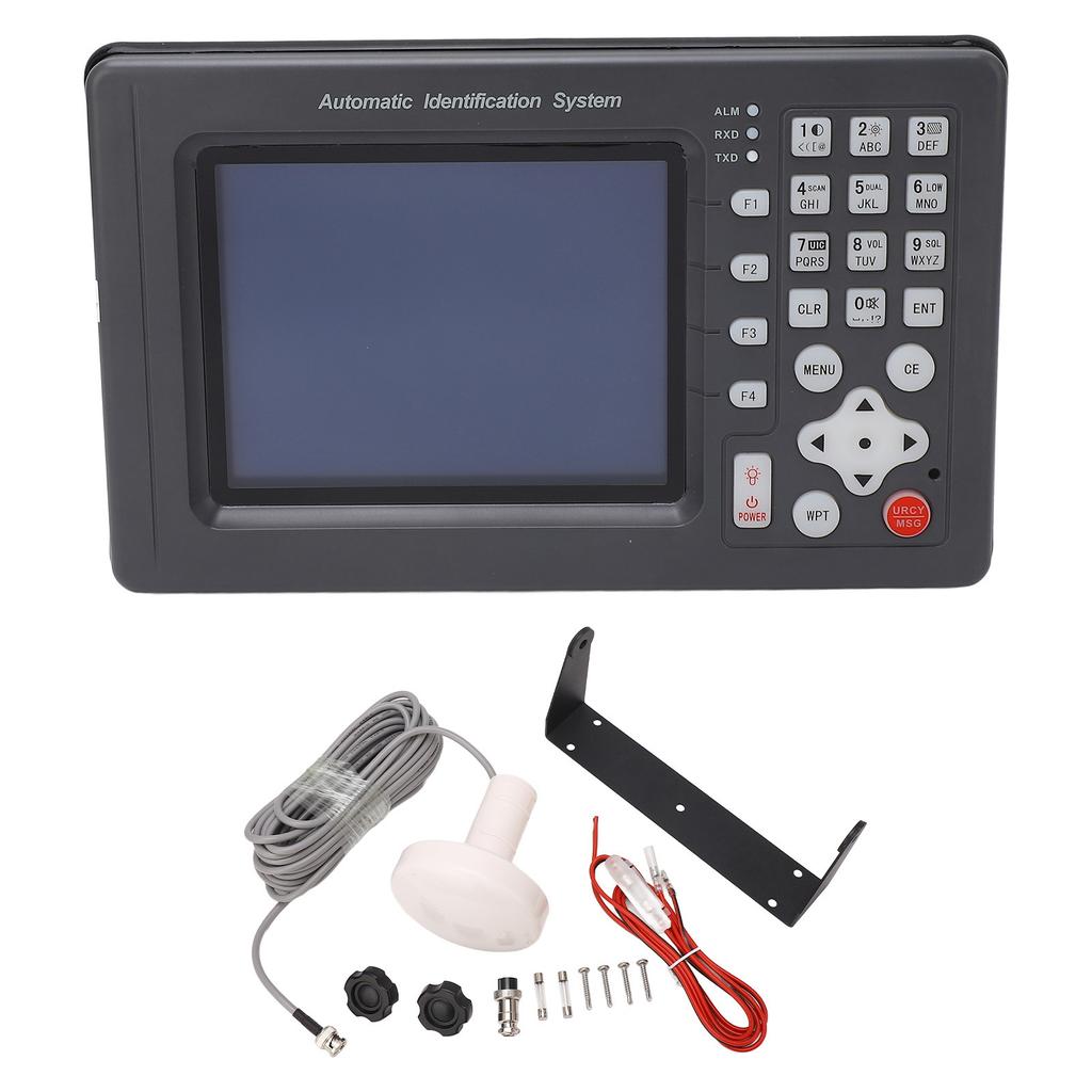
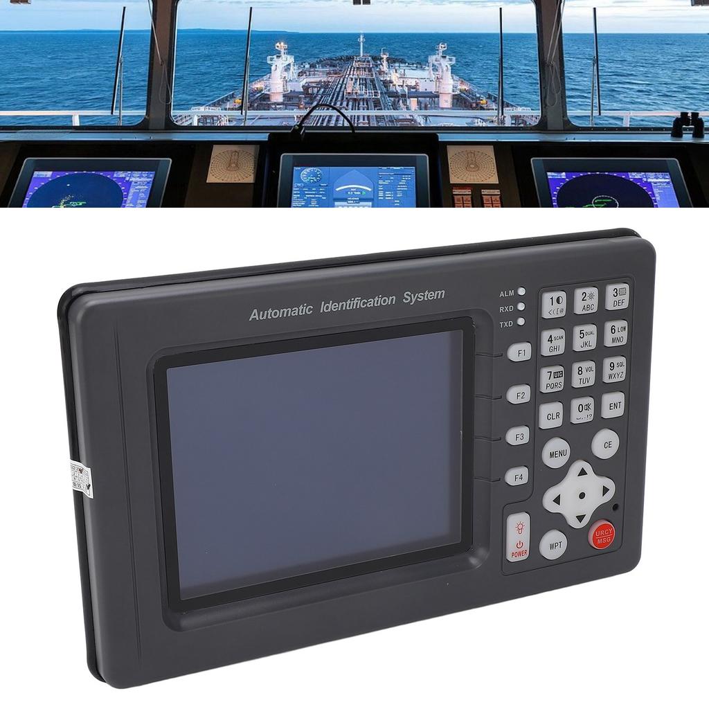

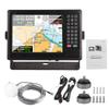
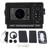
6in Automatic Identification System Satellite Navigator Collision Avoidance Instrument AIS Equipment


 Teslim edilmediğinde para iadesiKalite güvencesiGüvenli lojistikGizlilik koruması
Açıklama
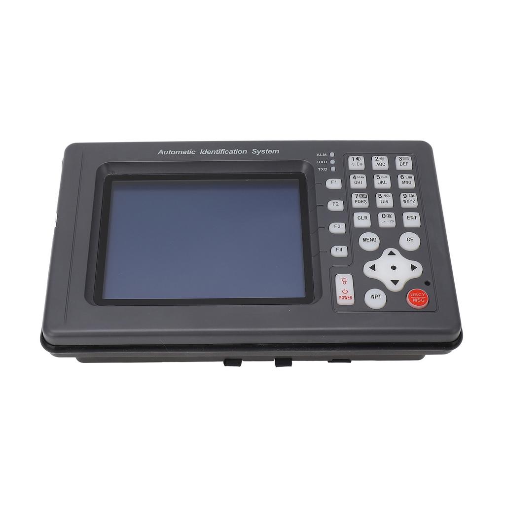
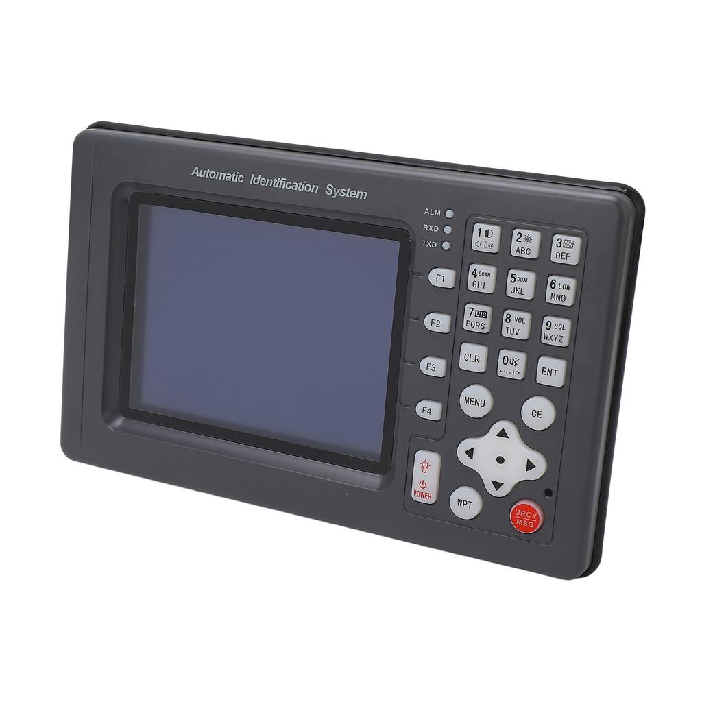
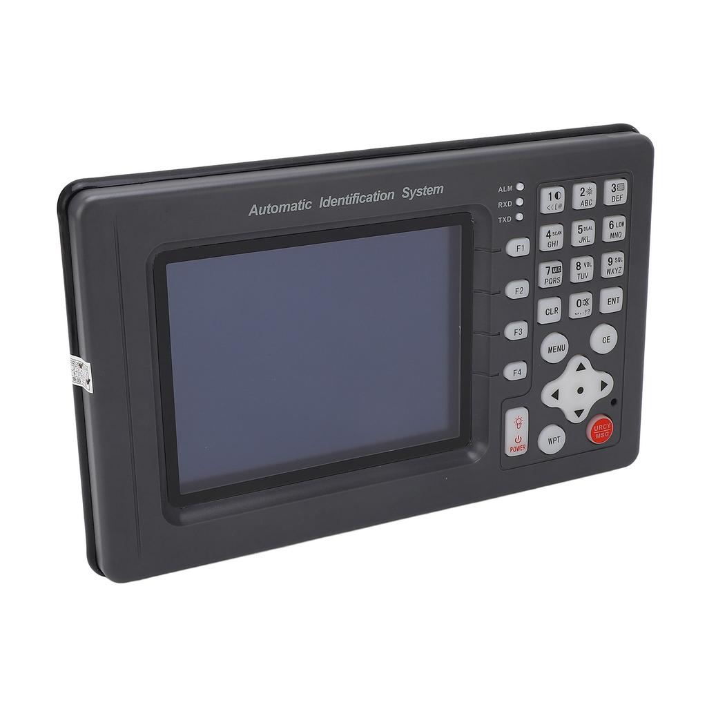
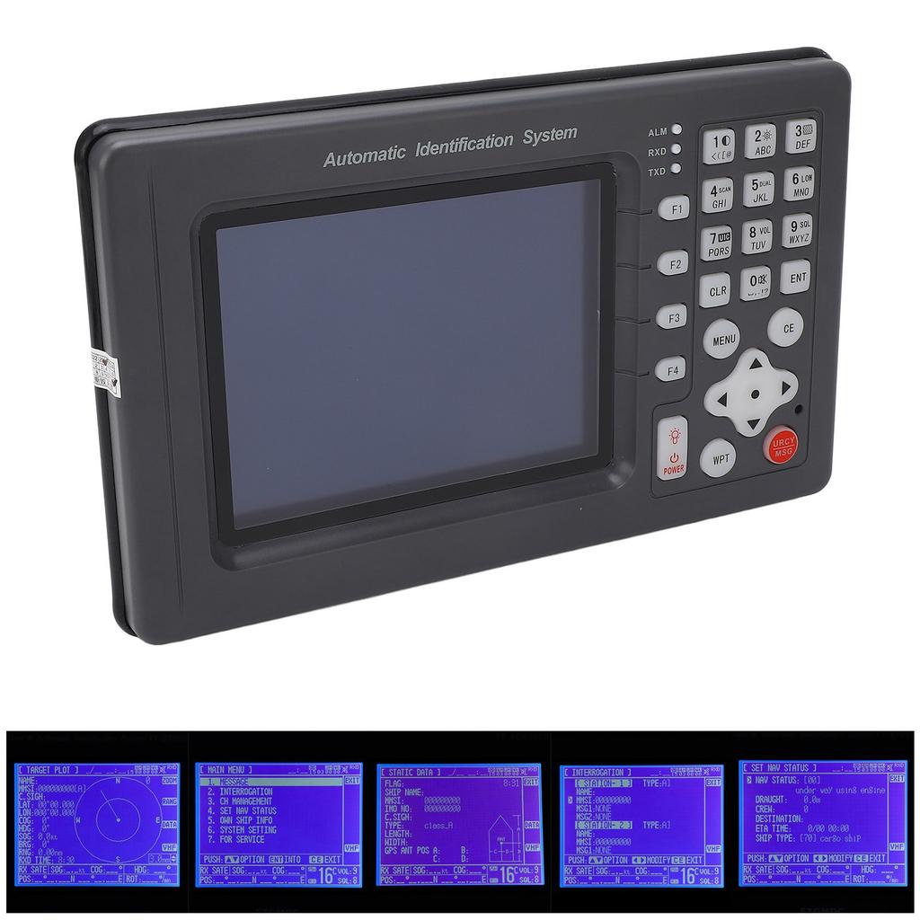
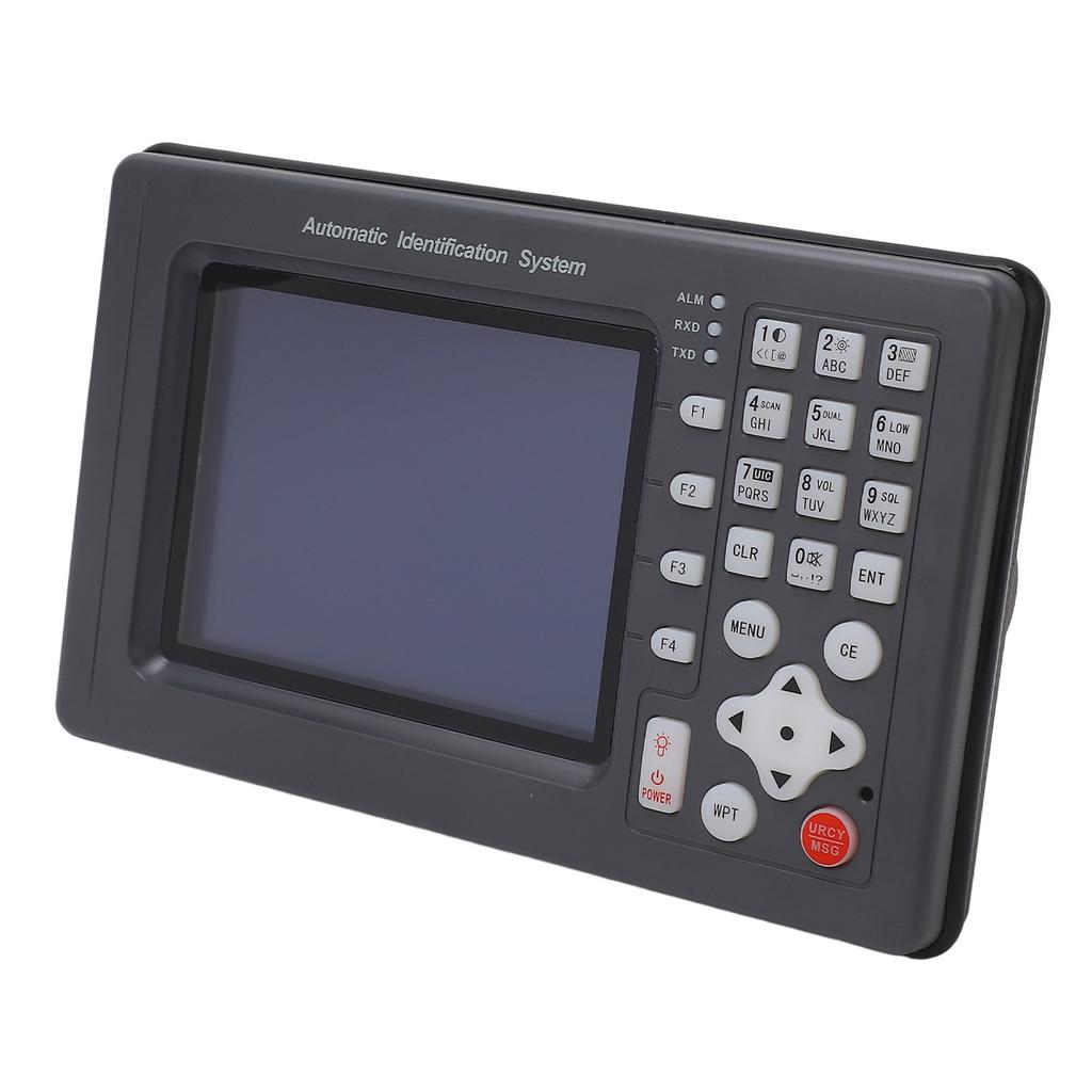
Feature: 1. The automatic ship identification system has many functions, which can continuously and autonomously receive and transmit AIS data information, and can also display the AIS data information of ships equipped with AIS equipment around the ship. 2. The static data of the ship automatic identification system includes: MMSI, ship name, call sign, IMO number, ship type, ship size, GPS antenna location, ship registration, etc. 3. The dynamic data of the ship automatic identification system includes: latitude and longitude, ship speed, heading, turning rate, bow, bearing, distance, etc. The navigation data includes: navigation status, draught, type of dangerous goods, destination and expected time, etc. 4. For AIS target ships within the set range, the automatic identification system can carry out light and voice prompts and alarms, and the alarm sound will continue to change as the distance approaches, supporting the sending and receiving of emergency information. 5. There is an alarm function. When a ship with a speed greater than 2 knots enters within a range of 0.1?10 nautical miles from the ship, the red indicator light on the display terminal will flash, and the speaker will emit an alarm sound: "Direction * * degrees, distance * * nautical miles away The boat is approaching. Please avoid it carefully." 6. There is a target ship information display function, the list can display the target ship (display distance, azimuth and 9?digit identification code, the vector display target ship can provide a range of 1?100 nautical miles, and it also supports the display of the target ship on the electronic chart. 7. Support GPS navigation function, use 6?inch color LCD display, can display the national coastline chart, place name information data and waypoints, routes and track settings, edit and delete operations. 8. Can display ship position, ship speed, course, track, time, date, etc., display the direction, distance and estimated time of arrival of the destination, and arrive, yaw, alarm and prompt when navigating the destination. 9. Supports the storage and recall of waypoints, routes, and tracks. It can store 10,000 waypoints, 10,000 marker points, 200 routes, and 200,000 track points. Specification: Condition: 100percent Brand New Item Type: Marine Navigator Material: Aluminum Alloy + ABS. Color: As Pictures Shown 1.This equipment is a generalpurpose shipborne AIS equipment, hard aluminum alloy shell, XP6 waterproof, and can exchange navigation and ship data information with other ships and shore stations. 2.This equipment complies with IMO"s MSC74 (69) appendix 3.A.694.ITURM.1373 and DSCITURM.825, and complies with IEC619932 (type test standard), IEC60945 (EMC and environmental conditions). 3.It is composed of transponder unit, display control unit, VHF and GPS antenna and related accessories. 4.The repeater unit includes a VHF transmitter, two TDMA receivers, a 70channel DSC receiver, an interface, communication processor, builtin GPS receiver, etc. 5.AIS ensures the safety of navigation by automatically exchanging navigation information with other ships or shore stations. Static Data: Call Number Ship Name Maritime Mobile Service Indentify(MMSI) IMO Number Ship Length and Width Ship Type The Position of the GPS Antenna on the Ship Dynamic Data:Ship"s Position UTC COG SOG Ship Heading Navigation StatusManual Input Code Rate of Turn Voyage Data: Draught Dangerous Cargo Type Port of Destination and Estimated Time of Arrival SecurityRelated Short Messages: Technical Index: Whole Machine Part: Radio Frequency Unit: 1 Transmitter, 2 Receivers Frequency Range: 156.025162.025MHz Channel Spacing: 25KHz Modulation Method: GMSK9600Bps, FSK1200Bps Frequency Error: +1000Hz Display Screen: TFT True Color 6in 15.24cm LCD ScreenPositioning Time: <120s Positioning Accuracy: Approx. <10m 10.9yd Working Voltage: DC12V or AC24V Working Temperature: 15 celsius +55 celsius AIS Transmitting Part: Carrier Power: 33dBm+1.5dB Modulation Spectrum: <25dBw <60dBw Modulation Accuracy: <3400Hz (Bit 0,1) 2400Hz+480Hz (Bit 2, 3) 2400Hz+240Hz (Bit 4199 or 00001111 Bit Format) 1740Hz+175Hz (for 0101 Bit Format) Spurious Emissions:
less than 36dBm (9KHz1GHz)
less than 30dBm (1GHz4GHz) AIS Receiving Part: Reference Sensitivity: less than 107dBm (Packet Error Rate less than 20percent ) Strong Signal Receiving Capability: 77dBm (Packet Error Rate less than 2percent ) 7dBm (Packet Error Rate <10percent ) CoChannel Suppression:> 10dB (Packet Error Rate less than 20percent ) Adjacent Channel Selectivity: >70dB (Packet Error Rate less than 20percent ) Spurious Immunity:> 70dB (Package Error Rate less than 20percent ) Intermodulation Immunity: >65dB (Packet Error Rate less than 20percent ) Blocking: >86dB (Package Error Rate less than 20percent ) Spurious Emission: less than 57dBm(9KHz1GHz)
less than 47dBm(1GHz4GHz) . Package List: 1 x Marine Navigator1 x GPS1 x Power Wiring1 x Base Bracket4 x Mounting Screws2 x Knob4 x Screw Washer2 x Fuse1 x Manuals The automatic ship identification system has many functions, which can continuously and autonomously receive and transmit AIS data information, and can also display the AIS data information of ships equipped with AIS equipment around the ship. The static data of the ship automatic identification system includes: MMSI, ship name, call sign, IMO number, ship type, ship size, GPS antenna location, ship registration, etc. The dynamic data of the ship automatic identification system includes: latitude and longitude, ship speed, heading, turning rate, bow, bearing, distance, etc. The navigation data includes: navigation status, draught, type of dangerous goods, destination For AIS target ships within the set range, the automatic identification system can carry out light and voice prompts and alarms, and the alarm sound will continue to change as the distance approaches, supporting the sending and receiving of emergency inf There is an alarm function. When a ship with a speed greater than 2 knots enters within a range of 0.1?10 nautical miles from the ship, the red indicator light on the display terminal will flash, and the speaker will emit an alarm sound: "Direction * * d


6in Automatic Identification System Satellite Navigator Collision Avoidance Instrument AIS Equipment — tüm dünyaya ücretsiz teslimat ile online ürün satın alın!
Mevcut renkler:
Kaliteli malzemeler:
Yüksek kaliteli fotoğraflar ve gerçek müşteri yorumları.
Büyük beden aralığı:
- köpekbalığı navigator parçaları
- köpekbalığı navigator dik vakum
- köpekbalığı navigator nv352
- köpekbalığı navigator döner artı
- köpekbalığı navigator asansör evcil hayvan
- navigator araba
- köpekbalığı navigator döner pro
- köpekbalığı navigator filtreleri kaldırın
- rotator vs köpekbalığı navigator
- köpekbalığı navigator lift-away
- Satılık ghost hunting equipment
- köpekbalığı navigator elektrikli süpürge
- 2004 navigator
- 2015 navigator
- köpekbalığı navigator dlx filtre
- köpekbalığı navigator ekleri
- köpekbalığı navigator vakum kaldırmak
- köpekbalığı navigator yedek hortum
- 2003 navigator
- 2010 navigator
- köpekbalığı navigator filtre
- toshiba satellite windows 7
- köpekbalığı navigator yedek filtreler
- köpekbalığı navigator pro
- köpekbalığı navigator vakum filtreleri
- köpekbalığı navigator aksesuarları
- navigator kamyon
- köpekbalığı navigator torbasız dik vakum
- köpekbalığı navigator vakum parçaları
- nioxin system 3 yorumlar
- nioxin system 2 yorumlar
- nioxin system 4 yorumlar
- navigator pro
- köpekbalığı navigator lift-away vakum
- köpekbalığı navigator pet
- Satılık home stereo system
- köpekbalığı navigator akülü vakum
- köpekbalığı navigator
- köpekbalığı navigator pet vakum
- navigator gps
- lucas oil fuel system cleaner incelemesi
- mesmerize şarkı sözleri system of a down
- Satılık dart target system
- köpekbalığı navigator elektrikli süpürge yorumlar
- köpekbalığı navigator hafif dik vakum
- köpekbalığı navigator lift artı
- köpekbalığı navigator silindir nasıl temizlenir
- köpekbalığı navigator vakum kaldırmak
- Navigator müziğinin uçuşu
- hayward navigator ayar kiti